Autostrade per l’Italia, in cooperation with Infrastructure and Sustainable Mobility Minister has started a huge modernization highways: interventions and installation of more modern and better performing boundaries materials with a total of 3100km. It will permit to contain crashes and, at the same time, to achieve lower noise pollution.
Key information
Project name: Highway A8 safety barrier modernization Plan
Date: 2022
Clients: Autostrade per l’Italia
Location: Lake highway (A8) Milan-Varese (Region:Lombardia)

Talk to our experts
Project details
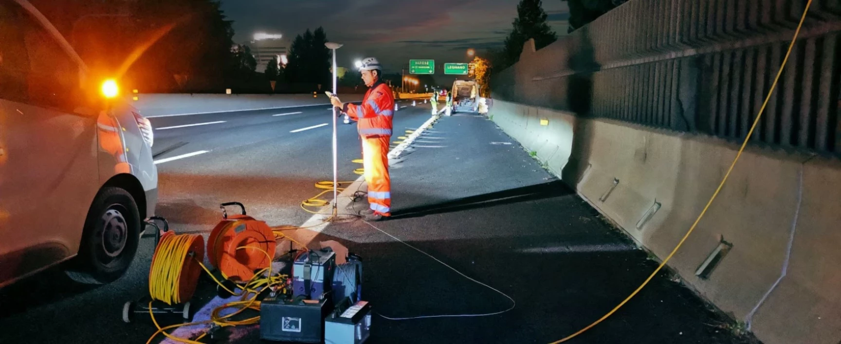
SOCOTEC carried out a geophysical survey to realize a first structure in CLS as a basis for other barriers. Before installing the new micropiles, SOCOTEC carried out an unexploded ordnance check.
The use of the magnetometry was not allowed because of the proximity with the working area, the curb boundaries, and the urban area.
The solution carried out to detect metal masses was the electrical resistivity tomography technique, supported by 3D polarizing induced measures. The aim of this study is to map the subsurface and identify at-risk smaller areas (risk analysis) to monitor and control.
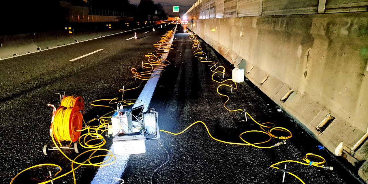
To collect data, we installed multiple geoelectric stendiums aimed at acquiring high-resolution 3D electrical resistivity and induced polarization data; the information, processed and inverted simultaneously, provided the parameterization in terms of resistivity and chargeability of the investigated subsurface volumes.
was carried out into the project “Highway A8 safety barriers modernization plan ante DM223/92”, the concept is to realize a structure in CLS as a base for other barriers. Before to realize new micropiles, it was necessary to chek the presence of ammunition.
The magnetometric technique was not allowed due to the proximity to the urban area in which the buildings and the citizens' sub-services are located.
So, to overcome the problem and find out possible metal masses presence we used the electrical resistivity tomography technique supported by 3D polarizing induced measures. The aim of this study is to increase our subsurface knowledge and select warning smaller areas (risk analysis) to put under control.
The data acquisition phase was carried out into the investigation areas by installing multiple geoelectric stendiums aimed at acquiring high-resolution 3D electrical resistivity and induced polarization data. The information, processed and inverted simultaneously, provided the parameterization in terms of resistivity and chargeability of the investigated subsurface volumes.
Investigation method used
Electrical Resistivity Tomography (ERT) technique
The direct current geoelectrical method is a geophysical prospecting technique widely used in various fields of application:
looking at underground water sources and monitoring pollution;
in engineering investigations to locate underground cavities, failures and fractures, permafrost, tunnels, etc.;
in archaeological research to map the areal extent of buried remains of the foundations of ancient man-made buildings.
Direct current geoelectrical prospecting determine the electrical resistivity of the subsurface being investigated, an intrinsic physical parameter of conducting media that expresses the lesser or greater susceptibility of a material to allow current to flow through it.
Induced Polarization (IP) survey
The induced polarization method (IP) is one of the “active” geophysical methods: we measure the spatio-temporal variation of the physical parameter chargeability by sending electric power directly into the subsurface. We evaluate materials’ ability in the subsurface to store electrical charges. In the geophysical literature, this phenomenon is also referred to as "induced polarization" because of the applied electric current.


