Ground stabilisation monitoring at Carrickfergus Abandoned Mines, UK
High-precision GNSS monitoring at Carrickfergus enabled real-time detection of ground movements, supporting safe and effective stabilisation works. Continuous data and automated alerts ensured informed decisions and long-term ground stability.
Key informations
- Project name: Carrickfergus Abandoned Mines Ground Stabilisation Monitoring
- Client: Northern Ireland Department for Economy
- Location: Carrickfergus, Northern Ireland
- Services provided: GNSS monitoring network design and installation, real-time ground movement detection and analysis , automated alert systems for critical movements, long-term deformation monitoring, data analysis and reporting, integration with grouting operations, risk assessment and mitigation support and multi-year monitoring programme management.

Talk to our experts

Project details
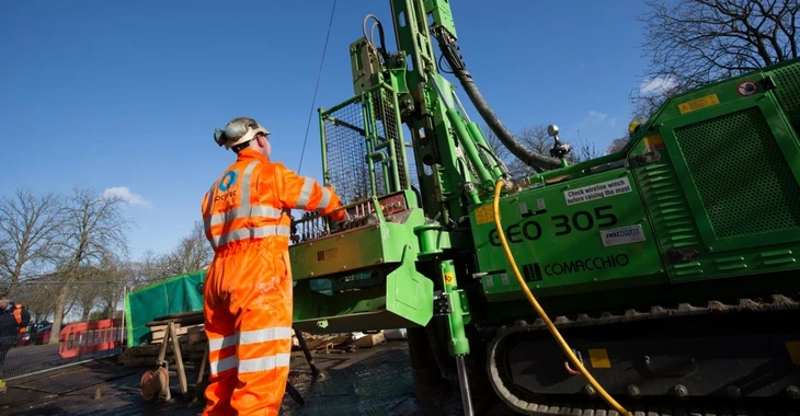
The Northern Ireland Department for Economy initiated a major ground stabilisation programme to address subsidence risks associated with abandoned mine workings beneath Carrickfergus town centre. The historical mining activities had created extensive underground voids that posed significant risks to surface structures and public safety.
The project required comprehensive monitoring to:
- Detect and measure ground movements in real-time during stabilisation works
- Provide early warning of any accelerated subsidence or unexpected ground behaviour
- Validate the effectiveness of grouting operations
- Ensure public safety throughout the stabilisation programme
- Monitor multiple locations simultaneously across the affected area
- Maintain continuous monitoring capability over an extended timeframe
- Provide reliable data in all weather conditions
- Enable rapid response to any significant ground movements
Our expertise
Comprehensive solution
Our team designed and implemented a comprehensive GNSS (Global Navigation Satellite System) monitoring network to provide precise, continuous ground movement monitoring throughout the stabilisation programme. The solution included:
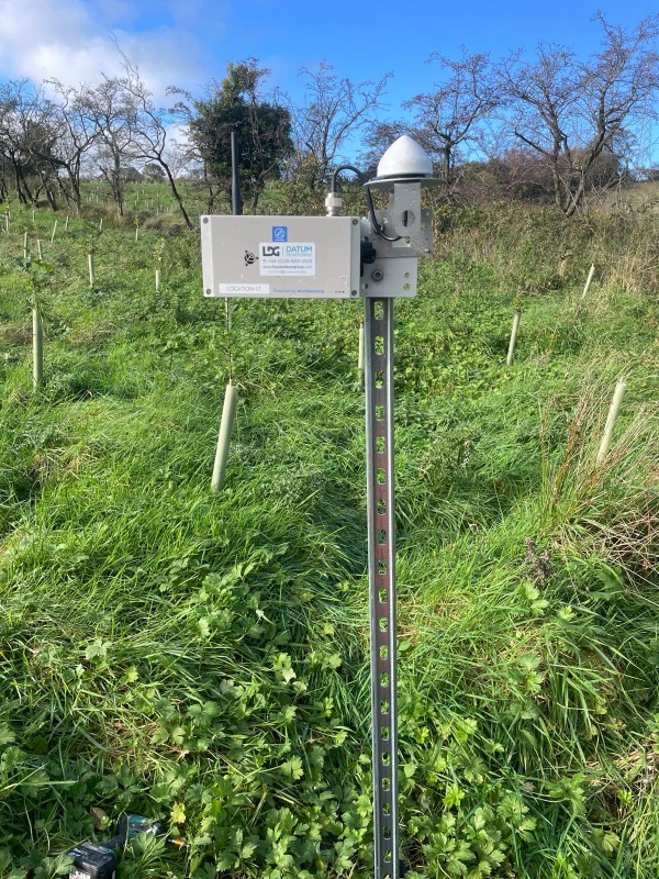
- Strategic placement of GNSS monitoring stations across the affected area to provide comprehensive coverage
- Installation of high-precision GNSS receivers capable of detecting sub-centimetre ground movements
- Establishment of stable reference stations outside the zone of influence
- Implementation of automated data collection and processing systems
- Real-time data transmission and analysis capabilities
- Development of custom alert thresholds and automated notification systems
- Integration of monitoring data with grouting operation schedules
- Creation of comprehensive reporting dashboards for project stakeholders
- Regular site visits for equipment maintenance and validation surveys
- Coordination with grouting contractors and project management teams
Our team designed and implemented a comprehensive GNSS (Global Navigation Satellite System) monitoring network to provide precise, continuous ground movement monitoring throughout the stabilisation programme. The solution included:
- Strategic placement of GNSS monitoring stations across the affected area to provide comprehensive coverage
- Installation of high-precision GNSS receivers capable of detecting sub-centimetre ground movements
- Establishment of stable reference stations outside the zone of influence
- Implementation of automated data collection and processing systems
- Real-time data transmission and analysis capabilities
- Development of custom alert thresholds and automated notification systems
- Integration of monitoring data with grouting operation schedules
- Creation of comprehensive reporting dashboards for project stakeholders
- Regular site visits for equipment maintenance and validation surveys
- Coordination with grouting contractors and project management teams
The GNSS monitoring network operated continuously throughout the multi-year stabilisation programme, providing millimetre-level accuracy in measuring both vertical and horizontal ground movements. The real-time monitoring capability allowed immediate detection of any unusual ground behaviour, enabling rapid response and adjustment of grouting operations as needed.
The monitoring data was integrated into the project decision-making process, helping to optimise grouting patterns, validate treatment effectiveness, and demonstrate successful ground stabilisation to regulatory authorities and stakeholders.
Key achievements
The ground stabilisation monitoring programme delivered critical safety and project management benefits:
Precision monitoring
Achieved measurement accuracy of ±2-3mm for vertical movements and ±3-5mm for horizontal movements.
Continuous operations
Maintained 99.5%+ system uptime throughout the multi-year monitoring period.
Early detection
Successfully detected and reported all significant ground movements, enabling proactive response.
Safety assurance
Provided continuous safety monitoring throughout grouting operations with no safety incidents.
Data validation
Monitoring data confirmed successful stabilisation with progressive reduction in ground movements.
Project confidence
Real-time monitoring provided stakeholders with confidence in stabilisation effectiveness.
Regulatory compliance
Comprehensive monitoring records supported regulatory approval and project sign-off.
Long-term performance
Extended monitoring confirmed long-term stability of treated areas.
Knowledge transfer
Monitoring data contributed to improved understanding of ground behaviour in similar geological settings.
This project demonstrates the critical role of precision monitoring in complex ground stabilisation programmes. The GNSS monitoring network provided the real-time data and early warning capabilities essential for safe and effective execution of the stabilisation works.
The successful completion of the monitoring programme has contributed to the long-term safety and stability of Carrickfergus town centre, protecting both public safety and valuable infrastructure. The project showcases our expertise in designing and implementing monitoring solutions for challenging geotechnical applications, and our ability to deliver reliable, accurate data over extended timeframes in demanding conditions.
The monitoring methodology and systems developed for this project have since been applied to similar ground stabilisation and subsidence monitoring projects, demonstrating the scalability and adaptability of our approach.
Want to know more about our services in the UK?